GIVE US A CALL TODAY(281) 363-3217
GIVE US A CALL TODAY(281) 363-3217
We offer in-house mapping featuring cutting-edge GIS technology to meet today’s industry standards. Our custom maps utilize affordable data with the ability to analyze, create, or upload any additional information.

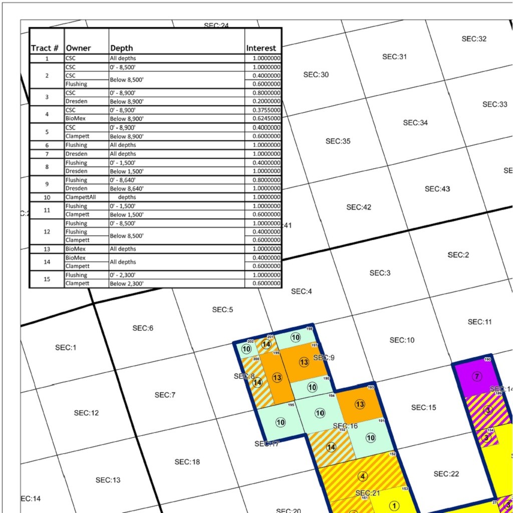
Leasehold Map
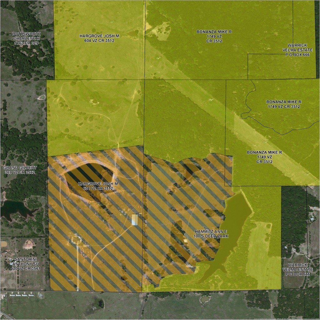
Aerial Basemap
Exploration Map
Creative Solutions
Accuracy is essential in a competitive workplace and geographic referencing is a must. Our map locations and acreage are plotted using modern satellite technology. ESRI’s ArcMap takes the guess work out of mapping to give our clients the assurance of precise and error free cartography, every time.
When clarity and communication are your most important goals, the maps you use need to look as good as they are accurate. We also utilize the powerful Adobe Creative Suite to craft your ideas into reality and deliver clear and comprehensive presentations using the industry standard in design.
Bring your maps into real time with Bluetick Land Management System. Every detail of your lease is accessible, exactly when you need it. LMS is a full featured land management system with integrated GIS web mapping and utilizes the best available security features to ensure the integrity and confidentiality of all your land data.